Snowplow Operations
How can Wightman help you improve your Snow Operations? We've developed solutions utilizing the latest ESRI technology to help you maintain the safety of your transportation network during winter weather events. Our main goal is to keep it simple! Our solutions are focused on making your operators more efficient, helping them stay safe, and ensuring that you can deliver on your established level of service to the community. Wightman's GIS team works with organizations to develop solutions so they can take on a snow event with confidence.
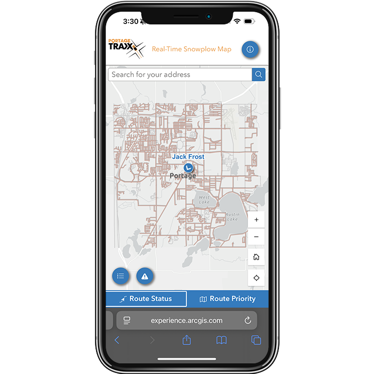
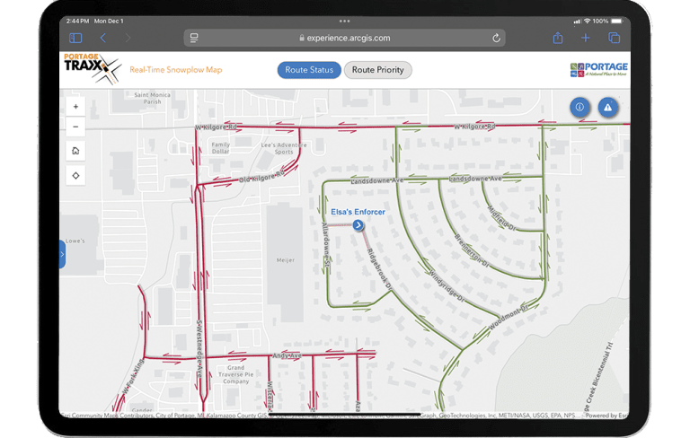
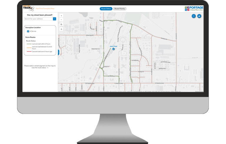
With the increase in frequency and severity of winter storms, now is the time to implement a solution that will improve your operational efficiency, save cost on fuel, material, and labor, and reduce training time for staff to learn your snow routes. Are you looking to track and communicate snow removal progress during winter storms? Our solution will help you increase awareness, transparency, and public trust through an online map that communicates what roads have been serviced.
Our solutions provide many benefits to your organization. Here are a few highlights:
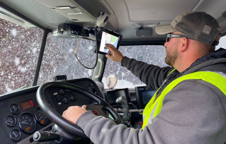
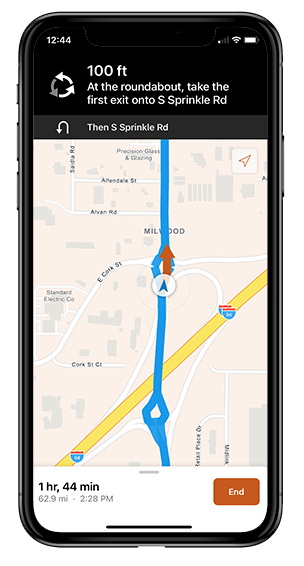
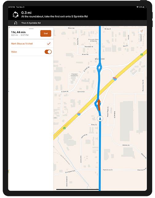
Turn-by-turn snowplow routing
- Transform your paper routing maps into voice-guided directions
- Routing is compatible with a phone or tablet
- Less training time required to learn routes
- Capture the knowledge base of seasoned operators
- More flexibility with staffing
- Increases safety of operators and motorists
- Staying on predefined routes:
- Increases operator efficiency
- Reduces material usage
- Reduces fuel costs
- Reduces wear and tear on equipment
- Reduces citizen complaints
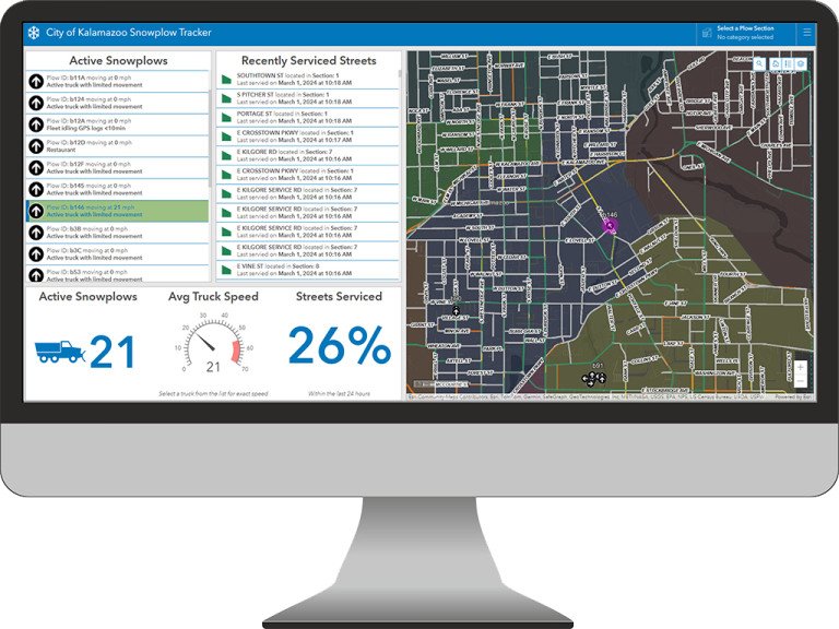
Real-time tracking of snowplow location and material usage
- Track and monitor the progress of snow removal or pre-treatment in real-time
- Improve communication and transparency to the public through online maps displaying snow route status updates
- Increase the efficiency and safety of snowplow operators and motorists during winter weather events
- Increase productivity and support data-driven decision making
Listen in to how this innovative technology is making a real impact to the City of Portage, or check out the Portage Traxx app here.
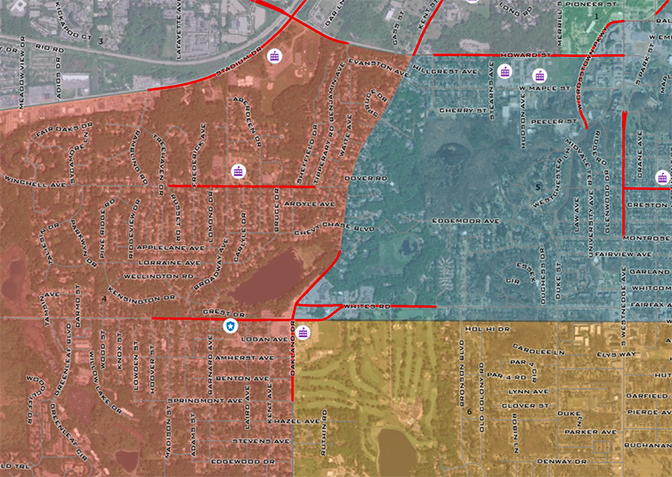
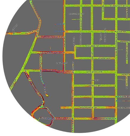
Snowplow route analysis and optimization
- Increase efficiency of snowplow operators with optimized routes
- Produce quicker response times during snow events
- Reduce costs including fuel consumption, wear and tear on vehicles, and maintenance
- Minimize environmental effects through lower emissions and focused pre-treatment
- Ensure the response to snow events is equitable throughout your community
What does the process look like?
- Document and map existing snowplow routes in GIS
- Data collection:
- Snow/ice related traffic crashes
- Location of critical infrastructure (hospitals, schools, fire stations, etc.)
- Slope (rate of incline)
- Land use changes/recent development
- Public transit and other emergency routes
- Traffic volumes
- Perform analysis based on your objectives of current routes against collected datasets
- Review the results, provide recommendations for route updates, and adjust based on feedback
- Monitor changing objectives and conditions such as new traffic patterns, new development, and update the routes accordingly
Interested in learning more? Contact our GIS team today!
Complimentary Services