Fire Department Pre-Incident Planning
Time is of the essence when a fire begins consuming a structure. The safety of all involved – citizens as well as first responders - is of the utmost importance. Wightman’s GIS team recognizes the noble work preformed by fire departments and is committed to working with them to improve their access to valuable pre-incident records from anywhere at any time.
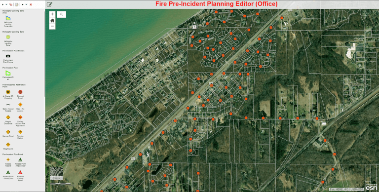
Fire departments typically perform site visits and conduct meetings with local businesses and schools within their service area. During these meetings information is collected regarding building size and material, type of business, location and condition of any fire prevention materials, average occupancy, location and distribution of exits as well as any flammable materials on premise. All this information once compiled make-up the pre-incident report that fire fighters can utilize as they are called out to an emergency.
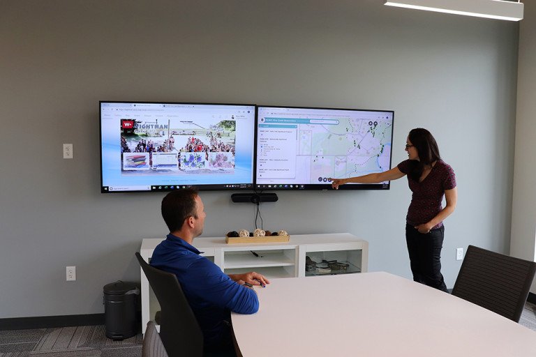
Using GIS technology, fire and safety departments can access interactive online maps from anywhere they are and quickly have critical information when it’s needed. All your building specifications, access points, photos of the structure as well as the location of potential harmful barriers that may be encountered all available in one place within seconds. By having this knowledge available during a critical time can be another lifesaving tool at their disposal.
Complimentary Services