Critical Incident Mapping
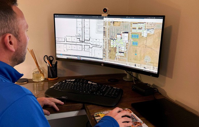
In an era where the safety and security of students and staff in educational institutions are paramount, school districts must take proactive measures to prevent and respond to critical incidents effectively. School Critical Incident Mapping represents a vital investment in the security of students, educators, and schools. It combines security assessments with facility safety and hazard inventories to create comprehensive maps of school properties, including detailed building layouts and campus surroundings, accessible to first responders during emergencies.
These detailed maps are made available to first responders, dispatchers, school administrators, and staff, equipping them with crucial insights into school layouts. By adopting a data-driven approach, the Wightman GIS team empowers districts to identify security patterns, vulnerabilities, and strengths, enabling evidence-based decision-making to enhance safety.
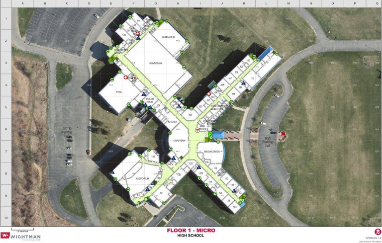
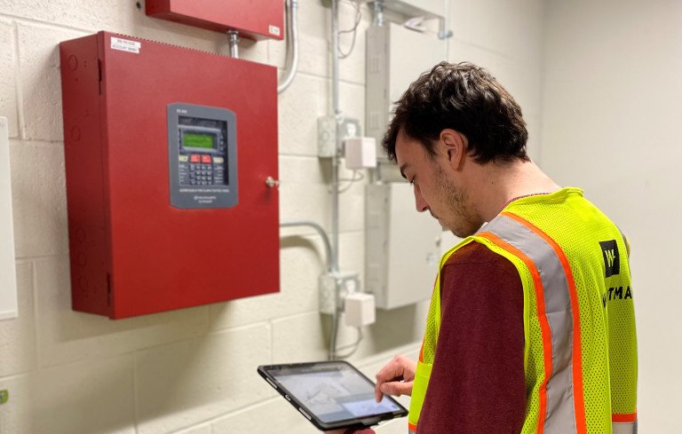
Our collaboration with GIS and first responder departments leads to the development of a standardized GIS database for mapping each school’s property. This database includes floor plans, site-specific labels, and other features to highlight essential aspects of the school. We also design consistent and accurate critical incident mapping templates, including Macro maps for an overview of the entire area and Micro maps that offer detailed information on building layouts, hazards, and safety equipment on each floor.
This groundbreaking tool:
- Enhances emergency response capabilities by eliminating the need to navigate unfamiliar locations during crises.
- Establishes a common operating picture, ensuring a unified understanding among first responders.
- Sharing digital floor plans with first responders saves valuable time, improving emergency response efforts for quicker, more effective interventions.
It's a game-changer in safeguarding our educational institutions and the well-being of everyone within them.
Wightman has successfully completed Critical Incident Mapping projects for multiple school districts in Michigan and Indiana, enhancing safety and emergency preparedness for students, staff, and first responders. By providing accurate, real-time data and detailed facility layouts, we help school administrators and emergency personnel respond quickly and effectively in critical situations. Our expertise in GIS, surveying, and planning ensures each district receives a tailored solution that strengthens school security and crisis response capabilities.
Funding for Critical Incident Mapping (CIM) will soon be available for schools in Indiana, providing districts with an opportunity to strengthen school security and crisis response capabilities. Wightman is ready to serve as your trusted advisor, helping Indiana school districts navigate the funding process and develop customized CIM solutions to enhance safety. For grant information, visit this site.
For schools outside Indiana, our GIS team is available to discuss how GIS technology and CIM can support your district’s emergency preparedness efforts. Contact our team today to learn more about GIS technology and how we can help implement this critical safety tool for your schools!
Complimentary Services