Cemetery Mapping
Cemetery data spread out between spreadsheets, handwritten and typed books, and coffee-stained maps paint a very real picture for many communities. The effects of disjointed data can cause headaches for Clerks and even frustration in the public. Some organizations have invested to consolidate their records but still can’t visual them on a map. There are many challenges that come with effectively operating a cemetery, and data is one of the biggest. If you have been working towards modernizing your historic records, you already know that it could take you years to do so on your own.
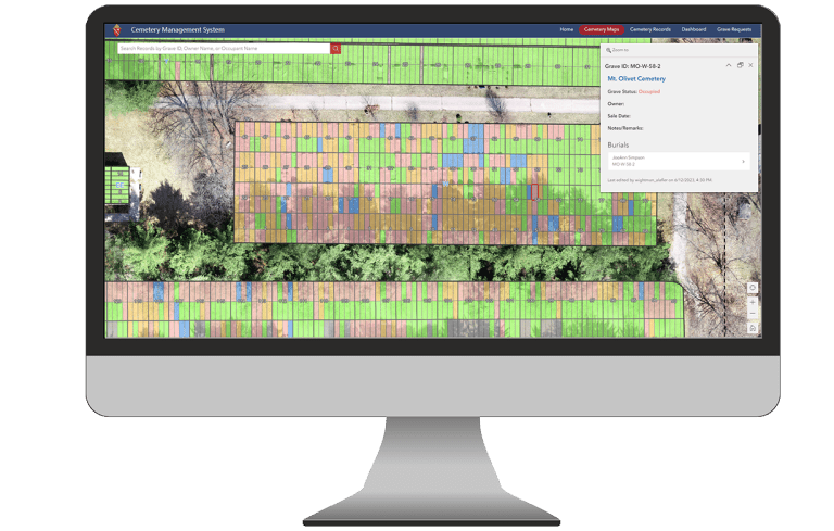
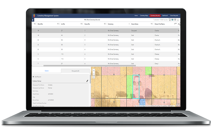
Wightman’s GIS team works with organizations to preserve their historic cemetery records and make them accessible through an interactive database and map. Your staff are enabled to visualize records like they haven’t before, finally being able to place a location with a name. Your cemetery system becomes an important planning tool, allowing you to visualize - and rectify - capacity issues before they occur. Citizens can now independently locate their loved ones, allowing your staff to focus on other important tasks.
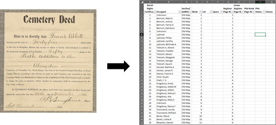
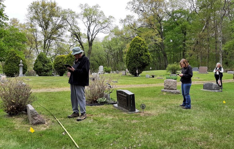
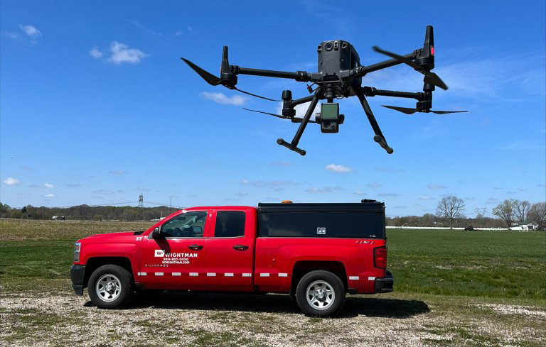
How do we do it? Depending on if you are just starting or are already knee deep in the project, Wightman’s GIS team will utilize its high-tech capabilities to document your records. Converting brittle paper maps to smart digital ones is a breeze, especially with high-accuracy GPS to locate known cemetery site features. Finally, we will develop an online interactive cemetery map that can be used by your staff and the public. Our Reality Capture team can also fly cemeteries with our drone to capture accurate and resolute imagery that can be used in the online map. Do you already have a cemetery management system, and just need an interactive map? We can work with you to connect your existing system with the interactive map, all without requiring your staff to learn new workflows.
Why maps cemeteries?
- Preservation of historical cemetery records
- Capture the knowledge base of seasoned staff
- Provide centralized access to records for staff
- Consistent placement and management of burials
- Provide a real-time picture of cemetery capacity
- Enable citizens to find loved ones using online interactive cemetery maps
How is Wightman different? Our main goal is to keep it simple! Wightman is a full-service firm for all your cemetery needs including:
- Cemetery records and map digitization
- High-accuracy GPS data collection
- Secure cloud-based cemetery records management software
- Site planning and cemetery expansion design
- High-resolution Drone imagery capture
- Ground Penetrating Radar (GPR) surveys
- Monumentation corners
Here are a few examples of how other communities are utilizing GIS technology for similar projects.
St Joseph Catholic Parish - Resurrection Cemetery
City of Dowagiac – Riverside Cemetery
Antwerp Township – Harwick Cemetery
Cemetery software highlights:
- Cloud-based with access from anywhere on any device
- Utilize your existing Esri GIS software
- Securely store cemetery records, documents, and photos
- Quickly search your entire cemetery database to find a record
- Gain valuable insights into your cemetery operations
- Quickly visualize and understand cemetery capacity
- Make quick and informed data-driven decisions
- Provide the community with easy online access to the cemetery maps and records
- Enable the public to find loves ones, explore availability, and request a grave site
Contact our GIS team if you would like to learn more about GIS technology and cemetery mapping. A handy brochure is also available for download Wightman Cemetery Services.pdf.
Complimentary Services