Van Buren County: How the Drain Office stepped into the 21st Century with Digital Transformation
Article | 09.02.2020By Ryan Miller, GISP
Connect with Ryan
**This article was originally published as part of the Michigan Associations of County Drain Commissioners Quarterly Publication Pipeline. Check out the full publication to see more.
Gone are the days where County office staff dust off decades old ledgers to pull property details such as names, legal descriptions, or lot sizes if an office needs to create an assessment district. No longer do staff need to spend countless hours looking at a pencil drawn map trying to determine property lines and contours in an effort to create and understand an assessment. Digital transformation (DT) is creating opportunities for easier workflows, faster search processes, and more accurate datasets for County officials across the state.
Digital transformation is simply the art of using technology – think computers and specialized software or programming - to analyze, sort, and provide accurate deliverables more efficiently and faster than traditional methods of data sorting. With many County budgets shrinking, it is imperative to utilize tools that create less work for staff.
Van Buren County, nestled just above the Michigan/Indiana border, in southwest Michigan encompasses four cities, seven villages, and 18 townships. Founded in 1829, the County ranks 25th out of 83 in the state based on county population (76,258) and 29th in terms of the size/footprint of the county (1,090 square miles).
This level of population and area has led to an incredible amount of land parcels and transactions.
Digital transformation is a big deal. So big, in fact, IDC estimated the total spending on digital transformations exceeded $2 trillion in 2019. Many industries are behind the curve on their own digital transformation. Using DT in the form of redesigning outdated practices is viewed as the primary driver by 51% of the government agencies as noted in a June 2019 joint study by Government Business Council and Ernst & Young LLP. Twenty-nine percent of government agencies interviewed pointed to data analytics as having the greatest impact on public sector transformation.
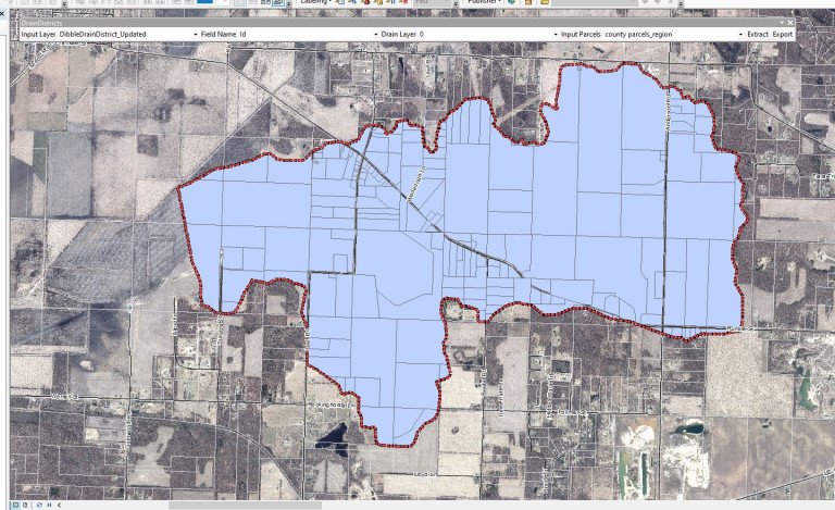
The Van Buren County Drain Office knows firsthand how digital transformation can positively impact a department. In 2006, the Drain Office started working with the County GIS (Geographic Information System) department to digitally preserve their legal drain courses and drain district records. Drain courses and districts were mapped in the GIS system using the historic, often paper legal descriptions and documents. Some of the documents dated back to the late-1800’s and are extremely fragile and sometimes nearly illegible. In the last few years, the Drain Office had the opportunity to scan and preserve the historical documents through Michigan’s Stormwater, Asset Management, and Wastewater (SAW) grant program. According to Michigan’s Department of Environment, Great Lakes, and Energy, the SAW program, which began in 2013, allows government units the opportunity to create, update, improve, or finalize asset management plans (AMPs) for wastewater and stormwater systems. AMPs are detailed plans that have three goals: save money, streamline and improve services to taxpayers, and inform taxpayers of potential improvements needed to the systems.
Investing in DT provides organizations like the Drain Office many advantages and opportunities. The Van Buren County Drain Office, like many, was looking for ways to do more with the time they had. In accordance with Michigan Drain Code Act 40 of Public Acts of 1956 as amended, staff wear many hats while managing the establishment, construction, and maintenance of over 540 county drains and stormwater management systems, 15 lake level control structures, Soil Erosion and Sedimentation Control (SESC) permitting, and a site plan development review program. Thankfully, the Drain Office has a wealth of experience and knowledge at its disposal. Joe Parman has spent 15 years as the Van Buren County Drain Commissioner and leads a team of three including a Professional Engineer and Surveyor, a Deputy Drain Commissioner, and an SESC and Drain Maintenance Supervisor.
The Drain Commissioners Office’s forward-thinking methodology of digitizing old land records led to increase efficiencies within their agency when it came time to administer assessments for drain projects. Wightman’s GIS team created a drain assessment tool that, using Drain Office and County GIS data, provides a fast and efficient way for staff to select a specific area on a digital map, push a button, and (dispense/create) an Excel spreadsheet that contains all property information including owner, mailing address, and parcel number. That spreadsheet can be used to facilitate communications with the affected property owners that live within a drainage district of any projects that requires assessment for improving, constructing, or maintaining a drain. The tool also offers Drain Office staff the ability to quickly develop assessment roles for use during the assessment process.
With faster data mining times, staff is able to efficiently provide contractors more accurate estimates for drain construction and maintenance projects. Most importantly, the use of DT equals an accurate, fair, and equitable assessment to landowners and a responsible use of taxpayer dollars.
Data used for mailings and assessments can now be gathered in seconds by the Drain Office. Following training led by Wightman GIS staff, changes and updates to the information can be made in CAD by drain employees and then that data is transferred back to the GIS database. This technology is not proprietary and can be utilized by any drain office.
“Digital transformation and GIS not only allow us to be efficient internally, but they also provide a means of communication to the community. Having accurate, timely, and consistent information about our drain assets at our fingertips allow us to make good data-driven decisions,” Drain Commissioner Parmen stated.
Moving forward, the goal for the Van Buren County Drain Office is to continue to provide innovative service to the citizens of the County and to work in concert with the internal resources to grow the use of GIS in others areas of the Drain Office and County. They have their eyes set on other GIS solutions for work management and more mobile access to their data. By collaboratively working together in concert with digital transformation in mind, both offices can save taxpayer dollars and time and that’s a win for everyone.
Ryan Miller, GISP, is the GIS Manager at Wightman. With 15 years’ experience in the field, he is an accomplished professional. He works with clients to acquire, analyze, manage, and interpret spatial datasets. In addition to managing a staff of four GIS professionals, he is responsible for business development, staff development, and project management within the department.